Missouri Downgraded In Latest Drought Monitor Map
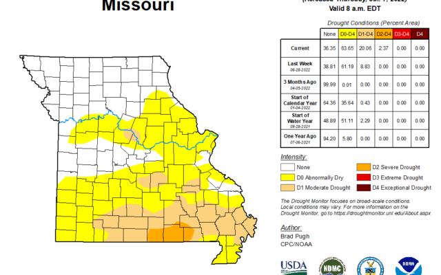
This week’s US Drought Monitor now shows about one-fifth of Missouri territory in moderate drought. The Drought Monitor is released each Thursday morning and includes rainfall collected through the previous Tuesday. Moderate drought is the first of four drought phases. Missouri’s drought territory increased by 12 points and is now realized in about 20 percent of Missouri. Much of Missouri’s new moderate drought territory came from pre-drought conditions being downgraded. Missouri’s pre-drought territory actually went down by about 9 percent. The map did show the first indication of severe drought in Howell, Oregon, and Ripley Counties in extreme southern Missouri. That area accounts for 2.37 percent of Missouri’s drought map. Missouri’s 65 percent of pre-drought or worse territory includes the southern two-thirds of the state. Most of the moderate and severe drought area is in the southern quarter of Missouri.
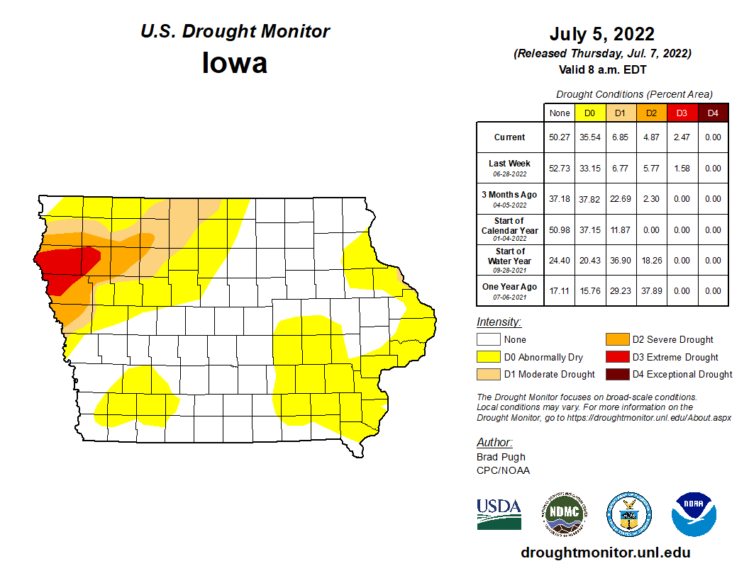
Iowa’s drought map is very similar to last week’s, with the 11 percent of moderate and severe drought territory confined to western and northwest Iowa. 50 percent of Iowa’s territory is in pre-drought conditions. The northern tiers of Taylor and Ringgold Counties show pre-drought conditions. Most of the southern Iowa territory in our region is still out of any dryness category. Much of Iowa received rain earlier in the week which may affect next week’s report.